
Montgomery Township Neighbors Sources
Public records show different parts of a Montgomery Township block. The map establishes parcel geometry and address context. The County Clerk’s land index can identify parties to a recorded instrument tied to a block and lot. Voter records have a separate, tightly limited request path. Community organizations can offer public contact information, but their membership lists are not a neighborhood directory. Read each source for the narrow fact it can establish, rather than treating any one result as a list of current neighbors.
| Source | What It Shows About a Block | Access |
|---|---|---|
| Montgomery General Map | Address point, PIN, block, lot, roads, streams, districts, and parcel geometry | Public address or block/lot search; no verified owner field |
| Somerset Clerk land index | Recorded instrument parties, date, document type, and legal description | AcclaimWeb index; legal-description search and record-room route |
| County voter-list request | Lawfully released voter data for a specified geographic area | Request form; political-purpose and no-resale terms apply |
| Civic contact pages | Public events, officers, or organizational contact details | Public contacts only; no membership inference |
| Library and history holdings | Past households, road names, and local context at a stated date | Branch, archive, or collection access |
Ownership and occupancy are different facts. The verified GIS layer does not publish an owner field, and a deed names parties to a transfer rather than everyone who may live at the property. A change in postal label, road name, or parcel boundary can also make two nearby records look less related than they are.
Montgomery Township Neighbor Parcels
Use the Montgomery General Map to search by normalized address or `BLOCK_LOT`. An address result can supply street text, post office, ZIP and ZIP+4, parcel ID, districts, road IDs, and map coordinates. A parcel result can supply a PIN, block, lot, zoning, sewer, acreage, flood, tax-map, and geometry fields. These fields provide the shared reference for comparing properties around a block.
Situs means the physical parcel or building location. A mailing address is where correspondence goes. Neither is a direct statement of present occupancy. The township’s Tax Assessor page directs assessment information to Web GIS, but research did not locate a separate public assessor form that exposes a human-facing owner, mailing-address, value, or exemption search. Do not treat the map’s technical CAMA or MODIV labels as a full tax card.
Map a Montgomery Township Block
Map outward from the subject parcel in a repeatable order. The public interface supports map browsing, parcel clicks, layer selection, and REST queries. It can show a subject polygon and surrounding parcels, but research did not verify a dedicated buffer tool or an automatic neighbors export. Work at one consistent scale so a long lot or corner parcel is not mistaken for a touching property.
- Locate the address in the General Map, then record the displayed PIN, block, lot, parcel ID, and address text.
- Click each parcel that touches the subject polygon. Record its PIN, block, and lot rather than assuming street numbers are consecutive parcels.
- Compare the road, stream, municipal edge, and parcel geometry. A long parcel may touch the block without having frontage on the same road.
- Use the block and lot in AcclaimWeb's legal-description search, then compare document type, recording date, parties, and legal description before treating the result as a lead.
The deed path should be read cautiously. AcclaimWeb has an online land index from 1977; its Alpha Index and older deed books are the route for earlier material. A current transfer party is not automatically a current neighbor. For a full named-street record chain, use the Montgomery Township street directory rather than trying to expand a block view into an entire road.
Montgomery Township Neighbors Map
The Montgomery General Map service directory exposes the municipal layer structure behind the public map. It is useful for understanding that address points and parcel polygons are separate layers. The service can show geographic details such as roads, water, buildings, and municipal adjacency, which are often more dependable block clues than a postal place name.
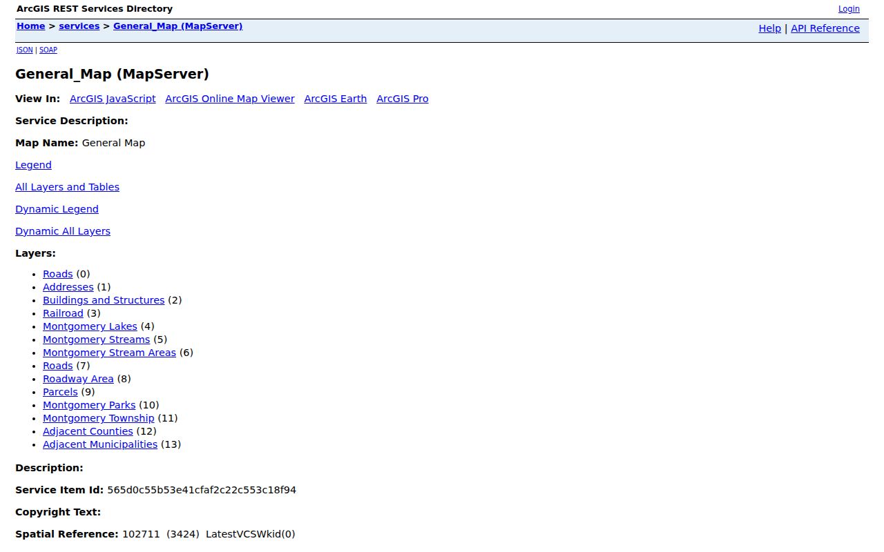
Use the service only to check the public map context. The inspected parcel schema has no owner or mailing-address field, and its technical field list is not a resident roster. A PIN and block/lot create a clean bridge to the County Clerk’s records without adding unsupported identity claims.
Note: Record road and water boundaries with each parcel, because they can explain why an apparently nearby address belongs to another block or municipality.
Montgomery Township Voter Requests
The state voter check is a name-and-date-of-birth lookup, not a street map. It can confirm a matching voter’s registration status and jurisdiction when the official form works, but it does not create a block roll. The Somerset County voter-list request form is the separate route for a lawful geographic request. It allows an entire county or another municipality, voting district, or described area, and it can request all registered voters or a defined subset.
Somerset's voter-list request form also allows voting history for up to five elections, each identified by year and Primary, General, or Other. Its terms restrict use to political purposes, prohibit commercial and non-election use, resale, and harassment, and state an expected one-to-two-week period. Delivery choices include email, CSV, PDF, or text when available; confirm any current price before ordering. Protected voters and restricted identifiers remain absent or redacted.
Montgomery Township Community Contacts
Community contacts can identify a public event, officer, or starting point for local participation. They do not establish that someone is a neighbor, attendee, or member. Montgomery Neighbors United is a township civic umbrella, while faith and service organizations in the local resource material serve areas that include Belle Mead, Skillman, and Blawenburg. Use their public contacts respectfully and do not turn contact pages into a personal roster.
| Montgomery Neighbors United | Township civic umbrella; public member directory was not located. |
|---|---|
| Montgomery Evangelical Free, Montgomery United Methodist, Blawenburg Reformed, and Harlingen Church | Public congregational contacts may exist; membership lists were not located. |
| St. Charles Borromeo, Congregation Kehilat Shalom, and Rahma Center of Montgomery | Public points of contact, not evidence of a person’s affiliation. |
| Princeton Elks, Montgomery/Rocky Hill Rotary, and scouts | Service, volunteer, and program contacts; member lists were not located. |
| Van Harlingen Historical Society | Local-history and hamlet context; no resident roster. |
Montgomery Neighbors United’s public home page shows the civic-umbrella source. It is a useful way to understand an organization’s public work, not a way to infer membership. The Guide to Montgomery supplies township and hamlet context for public community resources.
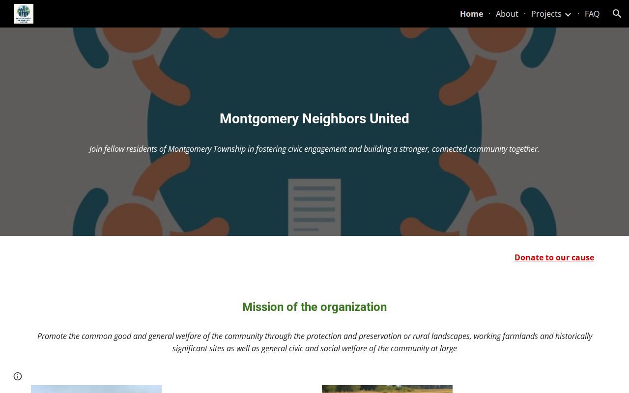
Public civic contacts are best used as contacts. Keep the parcel, deed, and voter routes separate from an organization’s event or outreach information.
Montgomery Township Neighbors Tools
Official sources and commercial neighbor tools serve different purposes. A commercial category can combine address histories and public-source associations, but those records can be stale, duplicated, or assigned to the wrong same-name person. They also cannot lawfully reveal protected, utility, delivery, or other nonpublic information. For a block question, the defensible route is a map polygon, a dated official record, and a narrow request when a custodian holds a releasable file.
| Official parcel and civic channels | Commercial neighbor tools |
|---|---|
| Show an address, parcel relationship, official instrument, or public contact with a stated source and date. | May combine address histories and public-source associations of uncertain currency or identity. |
| Have custodian rules, record dates, access limits, and correction paths. | Can carry duplicate or same-name errors and do not replace the underlying custodian. |
| Do not establish every household member or present occupancy. | Cannot lawfully fill gaps for protected people, utilities, delivery data, or private household information. |
Montgomery Township Neighbors Tip
INSIDER TIP: A map click gives the most useful working set for the next record step: the public address, PIN, block, and lot. Record those identifiers before opening the deed index. They avoid a same-street mix-up and make it possible to compare a parcel’s legal description with a recorded instrument. The General Map is the geographic link; ownership requires a separate County Clerk record check and the date attached to that record.
Road names deserve the same care. Montgomery contains hamlets and alternate road names, so an older entry can use a postal place or route name that differs from a current label. CR 601, for example, can appear as Great Road, Belle Mead Blawenburg Road, or Trent Place. Search the official and local names before deciding an address falls outside the immediate area.
Montgomery Township Neighbor Limits
Ordinary records cannot list every neighbor. People who rent their homes, household members, children, protected voters, Address Confidentiality Program participants, utility customers, delivery addresses, unlisted phone holders, and people named only in sealed law-enforcement or victim records may be absent by design. A voter result does not establish every household member. A deed does not establish current occupancy. A public community contact does not establish membership.
The New Jersey Address Confidentiality Program gives eligible participants a substitute address and mail-forwarding protection. OPRA also protects or requires redaction of private identifiers and exempt material. If a result suggests a protected address or a conflict, stop trying to triangulate it. The right response is to respect the restriction, not to search around it.
Lawful use. Use Montgomery Township neighbor records for personal, lawful research and civic awareness. Do not use a map, public contact, or records request to watch, threaten, stalk, or harass another person.